Analysis was performed by testing the GPS HERE 4 and CUAV on a test bench and HERE 3 on the drone itself. The GPS HERE 4 and CUAV were turned on throughout the day at the take-off point, HERE 4 was also turned on in another location in the city, as no number of satellites had been established at the location of the operation.
Example of a CUAV GPS LOG:

MAX:25 MIN:11 MEAN:18.68
https://drive.google.com/drive/folders/15BRxz0Uu-9BvYiuomQMzPprPsMH0WZjz?usp=sharing
Example of a HERE 3 GPS LOG:

MAX:15 MIN:09 MEAN:13.05
https://drive.google.com/drive/folders/15BRxz0Uu-9BvYiuomQMzPprPsMH0WZjz?usp=sharing
The GPS drift comparison between HERE 3 and CUAV was carried out throughout the day, both at the time of the comparison were next to each other.
Example of a HERE 4 GPS LOG:
Log taken from the operation site:
It is not possible to establish and maintain an unstable number of satellites.

MAX:00 MIN:08 MEAN:00.22
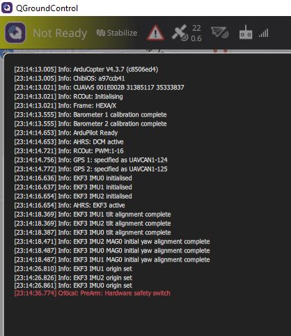
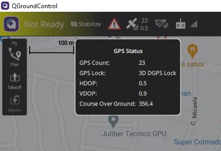
Status Mission Planner:

Log taken from another location in the city:
It is not possible to establish and maintain an unstable number of satellites.

MAX:06 MIN:00 MEAN:00.34
https://drive.google.com/drive/folders/15BRxz0Uu-9BvYiuomQMzPprPsMH0WZjz?usp=sharing