Hi all!
We’ve been observing some odd anomalies with recorded GPS locations from Here3’s. We’ve noticed that while we are taking multiple pictures in a single location, the recorded GPS coordinates are the same down to the seventh decimal point despite the drone that the Here3 is mounted on is moving 2-3 feet while taking the pictures. Shouldn’t the coordinates vary at least a little to account for the 2-3 feet of movement if its recording down to the seventh decimal?
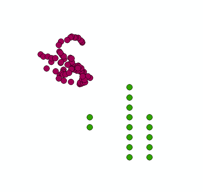
Just to compare the coordinates to another GPS device, we compared the coordinates recorded from a Micasense downwelling sensor to the coordinates recorded from a here3 in the same location. Those results can be seen below (here3 = green dots, Micasense = purple). The distance between the purple dots are 41-43 cm apart. Why is the Here3 points wandering in a grid pattern whereas the wandering points from the micasense wander in way that seems more reasonable? Is the Here3 snapping to a rounded GPS location?